About CAPE COD BAY - NAUTICAL MAPS
THE ALL NEW ADVANCED MARINE RASTER NAUTICAL CHARTS APP FOR BOATERS, ANGLERS, KAYAKERS, CANOER’S, FISHERMEN, WATER NAVIGATORS AND SAILORS! BOATING FRIENDLY INTERFACE & DESIGN! NO WAITING TIME FOR NAUTICAL CHART DOWNLOADS. R
THE ALL NEW ADVANCED MARINE RASTER NAUTICAL CHARTS APP FOR BOATERS, ANGLERS, KAYAKERS, CANOER’S, FISHERMEN, WATER NAVIGATORS AND SAILORS!
BOATING FRIENDLY INTERFACE & DESIGN!
NO WAITING TIME FOR NAUTICAL CHART DOWNLOADS. READY TO USE, SEAMLESS FOR CONTINUOUS NAVIGATION!
COMBINATION OF SMALL CRAFT AND HARBOR CHARTS FOR EASY NAVIGATION.
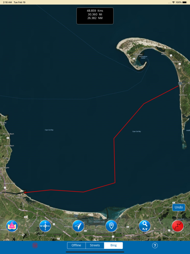
ALL LOADED NAUTICAL CHART POSITIONS ARE MANAGED IN A SEAMLESS ORDER AUTOMATICALLY!
CHART FEATURES:
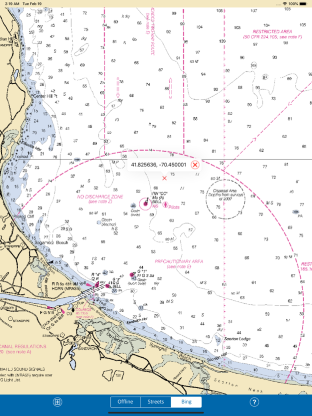
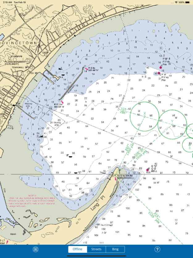
● ALL MARINE RASTER NAUTICAL CHARTS ARE FROM NOAA SOURCES.
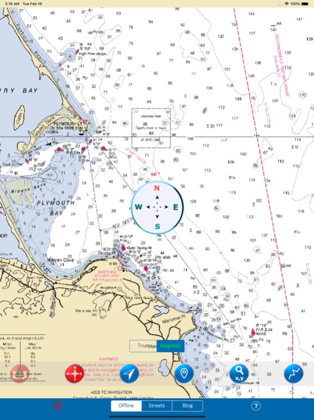
● INTERACTIVE COMPASS, MOVE AND PLACE ANYWHERE ON MAP SCREEN.
● ADD REFERENCE ROUTE ON MAP AND NAVIGATE SAFELY & SMOOTHLY.
● CONTINUOUS UPDATE OF YOUR LOCATION WITH GPS ON MAP.
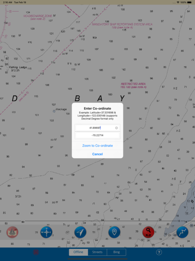
● FIND A PLACE MANUALLY USING LATITUDE, LONGITUDE (DECIMAL DEGREES FORMAT).
● GET ANY LOCATION COORDINATE WITH A SINGLE TAP.
● RASTER CHARTS DISPLAYED & VIEWABLE ARE PRECISE AND ACCURATE. USE THEM AS LONG AS YOU BOAT.
● SET ON/OFF NAUTICAL CHARTS DISPLAY.
● UPDATED USER INFORMATION.
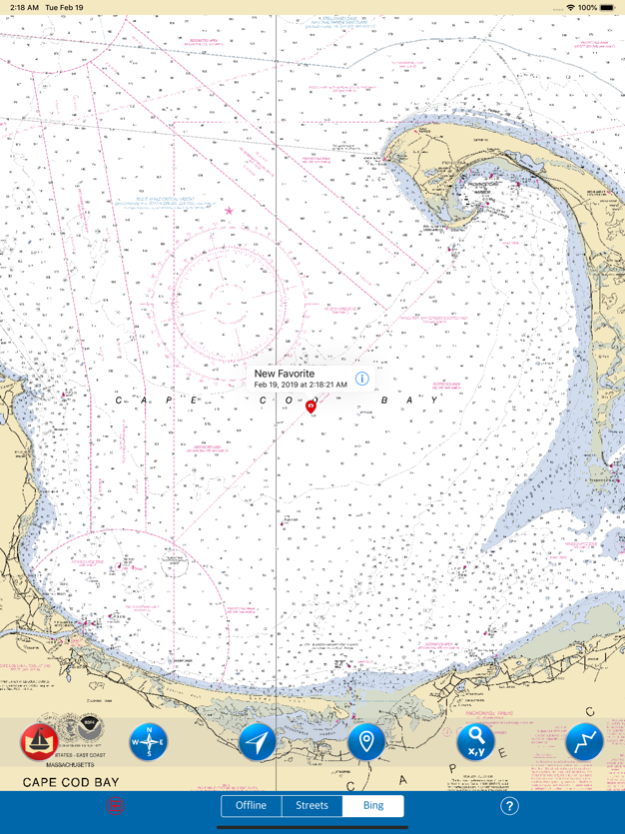
FAVORITE MARKER:
● INSERT UNLIMITED FAVOURITE MARKERS ON MAP.
● PHOTO TAGGED FACILITY FOR MARKERS WITH EMAIL OPTION.
● ADD MULTIPLE PHOTOS TO FAVOURITE MARKERS (MAX 3 ALLOWED).
● EMAIL FAVOURITE MARKERS AS KMZ FILE.
THIS APP IS MOST ADVANCED WITH ALL THE NECESSARY TOOLS FOR EASY NAVIGATION ON WATER. CONTINUOUS CHARTS DISPLAY MAKES IT MORE EASIER FOR SAILING AND AS THERE WILL BE NO INTERNET WHILE SAILING, THE OFFLINE CHART MODE IS FASTER FOR NAVIGATION.
NOTE : All charts are Geo-positioned to match the exact location of features displayed on charts but there may be some difference between the positions of actual objects that are in the water or sea and charts because of the different chart scales.
Disclaimer: The offline Raster Nautical Charts data provided in all charts is from NOAA and is for reference purposes only and not for navigation.
We strive to provide the best quality products to the boaters/sailors. We welcome suggestions from the users of this product to improve and make the map more useful.
HAPPY SAILING ALL THE TIME!
Jan 20, 2020
Version 3.5
- Bug fixed on Map not showing in lower zoom levels in iOS 13.
- iOS 13 Compatibility.
- Nautical Charts visibility improved.
Previous Versions
Here you can find the changelog of CAPE COD BAY - NAUTICAL MAPS since it was posted on our website on 2016-10-31 08:07:36.
The latest version is 3.5 and it was updated on 2024-04-22 10:04:06. See below the changes in each version.
CAPE COD BAY - NAUTICAL MAPS version 3.5
Updated At: 2020-01-20
Changes: Jan 20, 2020 Version 3.5
- Bug fixed on Map not showing in lower zoom levels in iOS 13.
- iOS 13 Compatibility.
- Nautical Charts visibility improved.
CAPE COD BAY - NAUTICAL MAPS version 1.0
Updated At: 2016-09-02
CAPE COD BAY - NAUTICAL MAPS version 3.5
Updated At: 1970-01-01
Changes: 20 de ene. de 2020 Version 3.5
- Bug fixed on Map not showing in lower zoom levels in iOS 13.
- iOS 13 Compatibility.
- Nautical Charts visibility improved.
CAPE COD BAY - NAUTICAL MAPS version 3.5
Updated At: 1970-01-01
Changes: 2020年1月20日 Version 3.5
- Bug fixed on Map not showing in lower zoom levels in iOS 13.
- iOS 13 Compatibility.
- Nautical Charts visibility improved.
CAPE COD BAY - NAUTICAL MAPS version 3.5
Updated At: 1970-01-01
Changes: 20 de jan de 2020 Version 3.5
- Bug fixed on Map not showing in lower zoom levels in iOS 13.
- iOS 13 Compatibility.
- Nautical Charts visibility improved.
Disclaimer
Official App Store Link
We do not host CAPE COD BAY - NAUTICAL MAPS on our servers. We did not scan it for viruses, adware, spyware or other type of malware. This app is hosted by Apple and passed their terms and conditions to be listed there. We recommend caution when installing it.
The App Store link for CAPE COD BAY - NAUTICAL MAPS is provided to you by apps112.com without any warranties, representations or guarantees of any kind, so access it at your own risk.
If you have questions regarding this particular app contact the publisher directly. For questions about the functionalities of apps112.com contact us.